搜索结果: 1-5 共查到“测绘科学技术 LAS”相关记录5条 . 查询时间(0.115 秒)
A REGISTRATION METHOD OF POINT CLOUDS COLLECTED BY MOBILE LIDAR USING SOLELY STANDARD LAS FILES INFORMATION
Mobile systems point cloud LiDAR registration LAS trajectory adjustment
2017/7/12
In the last few years, LiDAR sensors installed in terrestrial vehicles have been revealed as an efficient method to collect very dense 3D georeferenced information. The possibility of creating very de...
AN IMPLEMENTATION OF THE ASPRS LAS STANDARD
Lidar Airborne Terrestrial Laser Scanning Data Format LAS ASPRS Standards
2015/11/10
The laser scanning technology has become de-facto as a successful measuring mean in numerous applications of remote sensing and mapping. A development of hardware has been followed by a development of...
Cartographic-Environmental Analysis of the Landscape in Natural Protected Parks for His Management Using GIS. Application to the Natural Parks of the “Las Batuecas-Sierra de Francia” and “Quilamas” (Central System, Spain)
Landscape Cartography Natural Hazard Territorial Planning GIS Techniques Management Protected Parks
2013/3/5
In this work we report a methodological procedure with an integrated physical-perceptual approach that allows units of landscape in protected natural areas to be differentiated. First, indirect method...

光电研究院对地观测技术应用研究部顺利排除LAS仪器数据接收故障
对地观测技术 GPRS远程传输 LAS系统
2011/11/15
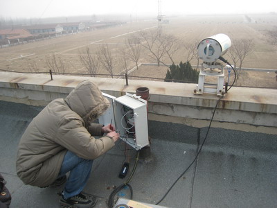
对地观测技术应用研究部于2009年4月在中国科学院山东禹城科学实验站顺利完成地表通量观测仪器LAS(大口径闪烁仪)系统安装,自此开始了黄淮海地区典型农业生态系统的地表通量长时间稳定观测工作,系统工作状态良好,并成功获取了一定时间序列的野外实测科学数据。

天地一体化遥感技术系统总体室顺利完成LAS仪器安装与调试
遥感技术 LAS仪器 山东禹城
2011/11/15
2009年4月21至23日天地一体化遥感技术系统总体室相关工作人员赶赴中国科学院山东禹城综合试验站进行大口径闪烁仪(LAS)的安装与调试,开始了地表通量的长期持续观测工作。总体室自2008年底赴山东禹城综合试验站考察以来,与禹城试验站及地方单位进行了多次接触与协调,并于2009年4月初确定了大口径闪烁仪(LAS)的最终安装方案。

