
搜索结果: 1-15 共查到“知识库 理学 technology”相关记录62条 . 查询时间(0.486 秒)
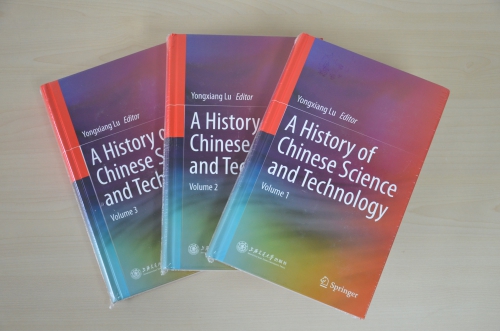
中国科学院路甬祥院士主编、中国科学院自然科学史研究所及国内相关单位专家合著的《中国科学技术史(英文版)》(A History of Chinese Science and Technology)一书,2015年7月由上海交通大学出版社和斯普林格出版社(Springer)联合出版。《中国科学技术史(英文版)》共三册,是在先期出版的《走进殿堂的中国古代科技史》中文本基础上重校、翻译而成。该书包括综论、...
IMPORTANCE OF INCORPORATION OF GEOSPATIAL TECHNOLOGY APPLICATIONS IN WATER RESOURCES AT GRADUATE AND POST-GRADUATE COURSES OF CIVIL ENGINEERING
water resources geospatial technology civil engineering course curriculum
2019/2/27
Water is a very crucial element to sustain life on earth. The availability of water varies both spatially and temporally. India being a water stress country, the per capita availability of water is re...
TRAINING, EDUCATION, RESEARCH AND CAPACITY BUILDING NEEDS AND FUTURE REQUIREMENTS IN APPLICATIONS OF GEOSPATIAL TECHNOLOGY FOR WATER RESOURCES MANAGEMENT
Geospatial technology Water resources Education and Training
2019/2/27
In India, water resources are managed at different levels, i.e. at central level by Ministry of Water Resources, River Development & Ganga Rejuvenation, Central Water Commission and Central Ground Wat...
AN EVALUATION OF MULTI TIER APPROACH TOWARDS CAPACITY BUILDING AND INSTITUTIONAL STRENGTHENING THROUGH APPLICATION OF GEO SPATIAL TECHNOLOGY IN PURVIEW OF AMRUT SCHEME
Capacity Building Multi Tier Approach Urban Planning Geo-spatial technology AMRUT
2019/2/27
Many initiatives around the world are emphasising to strengthen the capacities of civil society and local governments to build resilience towards the context of urban planning. The Indian cities are e...
APPLICATION OF INSAR TECHNOLOGY IN GEOGRAPHICAL SITUATION MONITORING
InSAR Geographical situation monitoring D-InSAR The terrain Deformation Interference figure Application
2018/5/15
In this paper, based on the geographical situation monitoring project of the earthquake zone of ludian county, zhaotong city, yunnan province,using the data of the radarsat-2 satellite (time frame is ...
RESEARCH ON THE CRUSTAL DEFORMATION CHARACTERISTICS IN BEIJING USING INSAR AND GNSS TECHNOLOGY
Beijing INSAR GNSS Crustal Deformation Geological structure
2018/5/14
In this paper, we tried to reveal the characteristics of the crustal deformation in both the horizontal and vertical directions in Beijing using InSAR and GNSS observations. Regarding the serious land...
STUDY ON KARST INFORMATION IDENTIFICATION OF QIANDONGNAN PREFECTURE BASED ON RS AND GIS TECHNOLOGY
Karst Landsat-5 TM Image RS+DEM Slope Karst Rocky Desertification
2018/5/16
Karst area is a pure natural resource base, at the same time, due to the special geological environment; there are droughts and floods alternating with frequent karst collapse, rocky desertification a...
DIGITAL TECHNOLOGY IN PRESERVATION OF BUDDIST MONASTERY TREASURES
Education Digital Documentation International Heritage Preservation Earthquake Risk Assessment Buddhist Monastery Preservation
2017/8/31
Treasure Caretaker Training (Digital Monastery Project), teaches Buddhist monks, nuns and community cultural caretakers to protect and preserve their own monastery sacred art treasures. Participants l...
Effects of the 6th September 2002 earthquake: damage amplification in the south-eastern sector of Palermo explained by GIS technology
GIS seismic response site effects Palermo
2015/9/17
During the 6th September 2002 earthquake the highest damage level in Palermo was observed in the SE sector.
This is a recent urbanization area where reinforced concrete structures predominate. A deta...
The exploration of eastern Mediterranean deep hypersaline anoxic basins with MODUS: a significant example of technology spin-off from the Geostar Program
deep-sea anoxic basins ROV
2015/9/7
A significant example of technological spin-off from the GEOSTAR project is represented by the special-purpose instrumented module, based on the deep-sea ROV MODUS, which was developed in the framewor...
Information technology tools for the valorisation of seismology’s historical documentary heritage
technology tools historical documentary heritage
2015/8/28
In the past few decades historical documentation of a scientific and non-scientific nature has taken on critical
importance in the different sectors of seismology: historical seismology and historica...
DOWNFLOW code and LIDAR technology for lava flow analysis and hazard assessment at Mount Etna
DOWNFLOW code LIDAR technology
2015/8/27
The use of a lava-flow simulation (DOWNFLOW) probabilistic code and airborne light detection and ranging (LIDAR) technology are combined to analyze the emplacement of compound lava flow fields at Moun...
Promoting ISPRS Aspirations in Geospatial technology application in Developing Countries and EReT Cameroon Approach to the International MSc Geoinformatics programs.
MSc International assistance Geoinformatics Resource Management
2015/8/24
Environmental Resource Trust (EReT) Cameroon is a Non Governmental Organization working on the development and promotion of
geospatial technology application with headquarters in Buea, South-West Pr...
Government has become preoccupied with the "relevance" of science. Congressman George Brown, Chairman of the U.S. House Committee on Science, Space, and Technology, now leads the fight in the United S...
In the spring of 1861 Matthew Fontaine Maury, whom many of us know as "The Pathfinder of the Seas" and the first Oceanographer of the U.S. Navy, had something of a change of heart and, perhaps as a re...